
Short answer: Navigation on the water means far more than typing an address into a smartphone. Nautical charts provide skippers with vital information about water depths, obstacles, and fairways. Those who master the basics of chart reading navigate more safely, more relaxed, and with significantly more enjoyment on the water.
The most important things at a glance
- Nautical charts differ fundamentally from land maps: they show water depths, underwater obstacles, and fairway markings instead of roads and buildings.
- The most important chart symbols are depth indications, buoys, beacons, shoals, and restricted areas.
- Depth lines (isobaths) show the seabed and help to identify dangerous shallow water zones.
- Paper and electronic nautical charts complement each other; neither completely replaces the other.
- GPS systems are precise, but not infallible: signal loss and outdated map data are real risks.
- Beginners often underestimate the difference between map scale and actual depth.
- Good navigation apps cost between 0 and 80 Euros per year, professional chartplotters significantly more.
- In bad weather and limited visibility, map competency becomes a real safety issue.
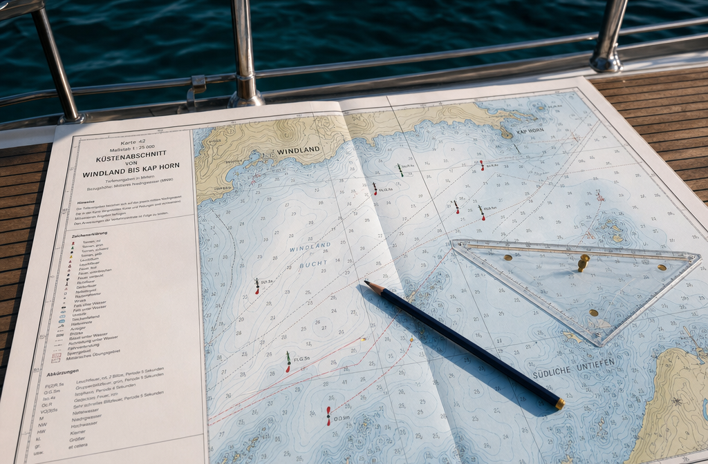
How do nautical charts differ from land maps?
Nautical charts and land maps pursue fundamentally different goals. A land map shows what is visible on the earth's surface. A nautical chart shows what is hidden below the water's surface and which routes are safe to navigate.
Specific differences at a glance:
| Characteristic | Land map | Nautical chart |
|---|---|---|
| Main content | Roads, buildings, elevations | Water depths, hazards, buoys |
| Depth indication | Not relevant | Central (in meters or fathoms) |
| Update | Every few years | Regularly, sometimes monthly |
| Scale | Variable | Harbor plans to coastal overviews |
| Authority | Land Survey | Hydrographic Offices (e.g. BSH) |
Nautical charts are issued and regularly updated in Germany by the Federal Maritime and Hydrographic Agency (BSH). For inland waters, i.e. rivers, canals, and lakes, the Waterways and Shipping Offices (WSA) are responsible. Those gliding through Brandenburg canals or Lake Constance on a houseboat therefore need different charts than a sailor on the North Sea.
What are the most important symbols on a nautical chart?
The most important nautical chart symbols are standardized and internationally defined by the IHO (International Hydrographic Organization) in publication INT 1. Anyone who knows these symbols can read any international nautical chart.
The most common symbols:
- Depth figures (blue or black): Water depth in meters below low tide (nautical chart) or normal zero (inland chart)
- Isobaths: Lines of equal water depth, similar to contour lines on hiking maps
- Buoys and markers: Colored symbols for fairway boundaries (red = starboard side, green = port side in the IALA system)
- Lighthouses: Star-shaped symbols with information on light characteristic, range, and color
- Shoals and rocks: Dots, crosses, or shaded areas for shallow or dangerous spots
- Restricted areas: Shaded or colored zones (nature reserves, military, harbor)
- Anchoring: Recommended anchorages
- Current arrows: Direction and strength of tidal currents
Tip for beginners: The legend of each nautical chart explains all symbols used. It's worth spending ten minutes with the legend before each trip, especially when navigating in unknown waters.
How do I correctly read depth lines and underwater topography?
Depth lines, also called isobaths, connect points of equal water depth and make the invisible underwater landscape readable. Closely spaced lines mean a steep drop, widely spaced lines indicate gently sloping areas.
For houseboat and leisure skippers: Always look for the depth line that meets your own draft requirement and plan a safety buffer. A houseboat with a draft of 1.20 meters should never navigate into areas with less than 1.80 meters of depth because charts are calibrated to low water levels and the water level fluctuates.
Common beginner mistake: The depth numbers on nautical charts refer to the lowest water level (chart datum). At high tide or flood, there is actually more water. However, at low tide, it can be even shallower than indicated if the bottom has been raised by sediment. Always check current water levels in addition.
What navigation tools do I need in addition to the paper chart?
The paper chart alone is not sufficient for a safe journey. Modern navigation on water combines several tools.
Basic equipment for leisure skippers:
- Compass: Independent of power and signal, an absolute must-have device
- GPS device or chartplotter: Shows real-time position on the electronic chart
- Sounder or echo sounder: Measures the current water depth below the keel
- Binoculars: For spotting buoys, lighthouses, and other vessels
- Clock: For dead reckoning (speed x time = distance covered)
- Navigation software or app: For route planning and real-time tracking
Travelers on a houseboat are usually on inland waters, where the requirements are somewhat less than at sea. Nevertheless, a functioning compass and an up-to-date map belong on every boat, no matter how short the planned trip is.
What does good nautical chart and electronic navigation cost?
Good navigation doesn't have to be expensive, but quality has its price. Here's a realistic overview for 2026:
| Product | Cost |
|---|---|
| Printed BSH nautical chart (single sheet) | 15–30 Euros |
| Chart set for a region (printed) | 60–150 Euros |
| Navionics app (annual subscription) | approx. 30–50 Euros |
| C-MAP charts (annual subscription) | approx. 50–80 Euros |
| Simple chartplotter (device) | 200–600 Euros |
| Professional chartplotter with echo sounder | 800–3,000+ Euros |
For occasional boaters on inland waters, apps like Navionics or the free OpenSeaMap app are a solid start. Those who regularly go to sea or rent a houseboat should invest in a reliable chartplotter or at least ensure that the rented boat is appropriately equipped.
What mistakes do beginners make when reading nautical charts at sea?
The most common mistakes in chart reading are avoidable once you know them. Navigation on the water requires attention to detail that beginners often overlook.
The most common beginner mistakes:
- Using outdated charts: Nautical charts must be updated regularly. A five-year-old chart can contain dangerous misinformation.
- Misjudging the scale: On a general chart, a shoal looks harmless. On the harbor plan, it is a serious obstacle.
- Ignoring tidal differences: Especially in the North Sea, several meters difference between high and low tide can decide between grounding.
- Blindly trusting GPS: GPS shows the current position, but not whether the chart data is up-to-date.
- Not comparing compass course with the chart: Those who only stare at the screen lose their spatial understanding of the surroundings.
- Underestimating the safety margin to shoals: The rule of thumb is: draft plus 50 percent buffer as minimum depth.
What apps help me with chart reading on the boat?
Several apps have proven effective for navigation on the water. The best choice depends on the sailing area and your own experience level.
- Navionics: Industry standard for leisure skippers, covers inland and coastal waters, good offline function
- C-MAP: Strong alternative with detailed depth data, especially for coastal waters
- OpenSeaMap: Free open-source alternative, good for inland waters in Germany
- Ozi Explorer: Proven for paper map digitization, more for experienced users
- Garmin ActiveCaptain: Well integrated with Garmin chartplotters, community data for harbors
Important: Apps do not replace official nautical charts or basic knowledge. They are aids, not a guarantee of safety. Always download an offline version of the maps before heading into an area with poor mobile signal.
How does navigation work in bad weather?
With limited visibility due to fog, rain, or darkness, chart competence becomes a real safety issue. Navigation on the water under difficult conditions requires more preparation and more trust in instruments.
Proven strategies:
- Plan the route completely before departure and mark critical points (shoals, narrow channels)
- Use radar or AIS, if available, to detect other vessels
- Reduce speed, increase reaction time
- Use compass course and log (speedometer) for dead reckoning
- When in doubt, anchor or head for a safe harbor
For houseboat users on inland waters: In dense fog, simply don't sail. Most inland areas do not have radar equipment on board, and the channels are often narrow. Safety comes before schedule.
What happens if I get lost while navigating?
Anyone who has gotten lost should remain calm and proceed systematically. Panic leads to wrong decisions that worsen the situation.
Steps for loss of orientation:
- Immediately reduce or stop speed
- Determine GPS position and compare with the map
- Trace last known position backward
- Compare visible landmarks or buoys with the chart
- If unsure: set anchor and clarify situation before proceeding
- In an emergency, contact Mayday: In Germany via VHF channel 16 or emergency number 124 124 (MRCC Bremen for the North Sea)
The most important thing: Never navigate into unknown, possibly shallow waters on suspicion. Better to take a detour than to run aground.
What do I need to consider with international nautical charts?
International nautical charts follow the IHO standard, but there are regional differences in depth indications, reference systems, and buoy colors. Anyone traveling abroad must be aware of these differences.
- Depth indications: Mostly meters in Europe, sometimes fathoms in Great Britain and the USA (1 fathom = 1.83 meters)
- Chart datum: Older charts use different geodetic reference systems than modern GPS (WGS84). Deviations can be up to several hundred meters.
- Buoyage system: Europe uses IALA-A (red = starboard), America and Japan use IALA-B (green = starboard). Mix-ups can be dangerous.
- Language of the chart: International charts use English or IHO-standardized abbreviations
Before traveling abroad, always obtain current official charts of the destination country and read the legend carefully.
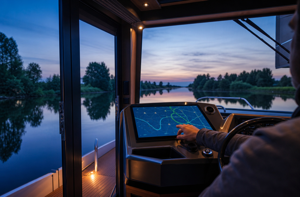
How accurate are GPS and electronic navigation systems?
Modern GPS achieves an accuracy of 3 to 5 meters under good conditions. With DGPS (Differential GPS) or SBAS correction signals, even under one meter is possible. For most leisure skippers, this is more than sufficient.
However: GPS is not infallible.
- Signal shadowHigh buildings, bridges, or rock faces can shield the signal
- Ionospheric disturbancesRarely, but real, especially during strong solar activity
- Map errorsThe GPS shows the correct position, but the map may be outdated or inaccurate
- Device failureElectronics can fail. Always have backup navigation (compass, paper map) ready
Frequently asked questions
Do I need a boating license to read nautical charts? No, chart reading is a skill that anyone can learn. However, a license is legally required for certain waters and boat sizes.
How often are nautical charts updated? Official nautical charts are continuously updated through "Notices to Mariners." Digital charts in apps often receive updates monthly or even weekly.
Can I use Google Maps for navigation on the water? Google Maps does not show water depths, shallows, or fairways markings. It is unsuitable and dangerous for water navigation.
What is the difference between a nautical chart and a harbor plan? A harbor plan is a large-scale detailed map of a single harbor or mooring area. A nautical chart shows a larger area in overview.
As a beginner, what is the best way for me to learn chart reading? Practical courses with ADAC Wassersport, the German Sailing Association, or local sailing schools are the fastest way. Good books and online tutorials are also available.
What does "chart datum" mean? Chart datum is the reference level to which all depth information on the nautical chart is referenced. It usually corresponds to the lowest astronomically possible water level.
Is Navionics also suitable for inland waters? Yes, Navionics covers many German inland waters, including Lake Constance, Müritz and the Rhine. Coverage varies by region.
How do I plan a route on a nautical chart? Divide the route from the starting point to the destination into waypoints, taking into account shallows, restricted areas, and fairways. Record each course section with compass bearing and distance.
Let's get on the water now
Reading charts is not rocket science, but it is a skill that makes a real difference. Those who understand the basics of navigation on the water, who read depth lines, know symbols and combine GPS with common sense, not only travel more safely, but also more relaxed and with more enjoyment. Every new chart is an invitation to discover an unknown area.
The best next step: Obtain a current chart of the planned area of operation, study the legend, and plan the route at the kitchen table before departure. This takes 30 minutes and can change an entire trip.
Ready for a houseboat holiday? Book your houseboat now with Campcruisers and experience navigation on the water up close, on calm canals, picturesque lakes and dreamlike river areas.


 English
  German
  Spanish
  Italian
  Polish
  Dutch
Dutch  French
  Danish